

Science Lesson: Understanding Convection and Weather
Once students understand how Earth’s surface is unevenly heated by the sun, they investigate how convection phenomena transfers heat around the planet, seeking equilibrium. They then explore how air masses are formed as a result of interactions between the atmosphere, geosphere, and hydrosphere, and cause changes in weather phenomena conditions around the planet as they move.
Science Big Ideas
- Weather and climate on Earth are complex and are influenced by a variety of different factors. However, the fundamental cause is that heat always transfers from warmer substances to cooler substances until the two substances are the same temperature.
- As the sun heats the ocean near the equator, that thermal energy is then carried toward the poles as water and air molecules interact and exchange heat with each other.
- The hydrosphere and the atmosphere are constantly interacting as they transfer heat between them.
- Wind moves around the planet in predictable patterns. The paths of wind are affected by Earth’s rotation.
- An air mass is a large body of air that has a similar temperature and humidity throughout. When a large mass of air remains over part of Earth for many days, it begins to take on the characteristics of the surface below it because heat and moisture are transferred between the surface and the atmosphere.
- Air masses don’t remain in the same place where they form. They usually begin to move, pushed by the planet’s winds.
- Global winds push air masses around the planet, so their movement is affected by temperature differences, Earth’s rotation, and surface features, such as mountains.
- Weather maps also often indicate high and low pressure systems. A high pressure system is noted with a blue “H,” and a low pressure system is noted with a red “L.”
- Weather forecasting remains very challenging because even a small change to any one variable can have dramatic effects on Earth’s weather.

Discover Complete Hands-on Screens-off Core Science Curriculum for K-8 Classrooms
Prepared hands-on materials, full year grade-specific curriculum, and personalized live professional development designed to support mastery of current state science standards.
Science Essential Questions
- Why does heat move from the equator to the North and South poles?
- Why do warmer fluids rise while cooler fluids sink?
- Why are ocean currents an example of convection in water?
- How is movement of wind similar to the movement of ocean currents?
- How do water molecules from the ocean exchange thermal energy with the atmosphere?
- Why is it important for Earth’s climate that heat is distributed around the planet?
- How does the Coriolis effect cause wind to move in the Northern Hemisphere?
- What happens to the heat and moisture carried by an air mass?
- What happens when two air masses collide with one another?
- Why are strong storms often associated with cold fronts?
- What are some of the instruments that scientists use to help them predict weather?
- Why does forecasting for one location need weather data from locations around the world?
Common Science Misconceptions
![]() Misconception: Air’s humidity and temperature are the same everywhere on Earth.
Misconception: Air’s humidity and temperature are the same everywhere on Earth.
![]() Fact: Air around Earth differs in both humidity and temperature. Differences in temperature are what cause convection, which transfers heat around the planet.
Fact: Air around Earth differs in both humidity and temperature. Differences in temperature are what cause convection, which transfers heat around the planet.
Science Vocabulary
Air mass : a large body of air that has a similar temperature and humidity throughout
Climate : the average weather in a location over 30 years or more
Convection : heat transfer in fluids (liquids and gasses) where warmer, less-dense fluid rises, allowing cooler, denser fluid to take its place; causes a tumbling motion in the fluid
Front : the boundary between two air masses; four kinds of fronts: cold fronts, warm fronts, stationary fronts, and occluded fronts
Weather : the conditions of the atmosphere (temperature, humidity, wind speed, and precipitation) at a particular place and time
Wind : moving air
Lexile(R) Certified Non-Fiction Science Reading (Excerpt)
The Blizzard of 2015
In January 2015, New York City did something it had never done before. It shut down the subway system because of the weather forecast.
A powerful storm was moving toward Canada and the central and eastern United States. In response, six U.S. states declared a snow emergency, and four states banned all travel except emergency vehicles. Thousands of flights were canceled, as were many schools around the region.
The decision to shut down New York City’s subway was controversial because more than 4 million people use the subway every day. People became angry because the storm ended up dropping much less snow in New York City than had been predicted.
This blizzard showed how difficult weather forecasting can be. Some news outlets called the difference between the forecast and the actual snow amounts in New York City one of the most famous forecasting “busts” of the 21st century.
However, many forecasters and other scientists have said that overall, the forecasting was pretty good. Models showed that there was going to be an extremely powerful storm—and there was. The problem came down to the storm’s exact path. For example, forecasting for central Massachusetts was spot- on, with the region receiving record-breaking amounts of snow. However, forecasters predicted that New York City would fall within the western boundary of the storm. In the end, the city was outside the storm’s western boundary.
Weather and Climate
The blizzard of 2015 was one kind of weather event. Weather is the conditions of the atmosphere in a particular place at a particular time. Temperature, humidity, wind speed, air pressure, and precipitation are all parts of weather. Climate is an average of the weather in a location over 30 years or more. The uneven heating of Earth’s surfaces, along with the cycling of water around the planet, are major drivers of weather and climate on Earth.
Weather and climate on Earth are very complex, influenced by a variety of different factors. However, the fundamental cause is that heat always seeks equilibrium. It does this by transferring from warmer substances to cooler substances until the two substances are the same temperature. Because the sun heats Earth unevenly, heat is constantly transferred from warmer locations to cooler locations seeking equilibrium. This transfer of heat around the planet regulates Earth’s climate. Without it, regions near the equator would be much hotter, while regions near the poles would be much colder.
Ocean currents are one way that heat is transferred around the planet. Deep ocean currents transfer heat through a form of heat transfer called convection, where warmer, less-dense fluid rises, allowing cooler, denser fluid to take its place. Ocean currents push warm and cold water to different parts of the planet. Cold, dense water in the oceans sinks deep and spreads out all around the world. The sinking water is replaced by the warm, less-dense water near the surface that moves to the north.


Hands-on Science Activity
For the main hands on activity of this lesson, students analyze the motion of hot and cold water to discover the role of convection phenomena in transferring heat in fluids. They also figure out how the motion of air masses result in changes in weather conditions during tornado season. In the first investigation, students apply the process of convection to air convection in the atmosphere, figuring out how air convection is connected to different types of weather, such as cloud formation phenomena, precipitation phenomena, and at times, thunderstorm phenomena.
Science Assessments
KnowAtom incorporates formative and summative assessments designed to make students thinking visible for deeper student-centered learning.
- Vocabulary Check
- Lab Checkpoints
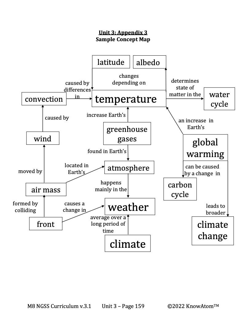
- Concept Check Assessment
- Concept Map Assessment
- And More...

See How KnowAtom Aligns to NGSS Science Standards
Discover hands-on screens-off core science curriculum for student centered K-8 classrooms. KnowAtom supports classrooms with all hands-on materials, curriculum, and professional development to support mastery of the standards.
